|
Coming south from Bath on State Rt 209 from US 1, bearing left across the causeway into the village of Winnegance. Places to note: The Ten Tide Mills which once was operated at Winnegance and the Morse Lumber Mill (1801). The Morse Lumber Mill is still currently managed by the same family.
|

|
|
About 1.5 mi. further on the left is Fiddler's Reach Rd. which leads to the sites of Fort Noble (1734) and the Pleasant Cove Meeting House (1736) overlooking the Kennebec.
|

|
|
Another mile south on 209 is Drumore Bay on the left. From Butler's Hill you can see Phippsburg Center, Lee's Island, and a commanding view down the Kennebec River.
|

|
|
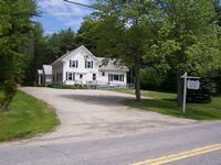
Next is Stoneybrook. Stonybrook was where schooners were built from 1867 to 1890. Note the 200 year old brick manor house on your right. Stoneybrook Road leads to the west side of town (see Meadowbrook section).
|

|
|
Next on 209 is Phippsburg Center Store, it is now called Bisson's. But it was formerly called Percy's, Pease's, Snipe's, Shorey's, Parks', Shores', Reid's, DeMello's, Ridgewell's, and DeMello's.
|

|
|
Take Parker Head Rd. opposite the Center Store and the 3rd building on the left is the Phippsburg Historical Society Museum which is open summers Monday-Saturday 10:00-2:00.
|

|
|
Next to the museum stands the Albert F. Totman Library (1923) The library houses over 10,000 volumes including local reference material and a large collection of art books
|

|
|
At the next curve is the architecturally important James McCobb House (Which is now a B &B called the 1774 Inn).
|

|
|
Church Lane on the left leads to a scenic area and the Phippsburg Congregational Church (1802)
|

|
|
Continuing south on Parker Head Rd. you soon pass the remains of two shipyards on the left opposite Center Pond. Originally a salt marsh, Center Pond was dammed in 1883 for ice harvesting.
|

|
|
Continuing on Parker Head, Parker Head was once home of many famous sea captains and marine engineers. It is said that Benedict Arnold stopped here for a rum toddy on his way to Quebec.
|

|
|
Around the second sharp right turn is Parker Head Landing. From here one can see the old mill pond, clam diggers, and the Perkins Light, house and bell-tower.
|

|
|
1/2 mile from Parker Head on corner of Cox's Head Rd is the Old Stone Schoolhouse (1836), now a private residence
|

|
|
Left on Cox's Head Rd to the end are the remains of an 1812 military earthworks. Views from here show the mouth of the Kennebec, Ft. Popham and the islands beyond.
|
|
|
From Cox's Head continue South to the intersection of Rt 209. Left on 209 the road winds through salt marshes, past sandy beaches to Popham Beach State Park on the right.
|

|
|
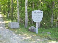
Continue to Popham Beach Village. Left on Hoss Ketch Pt at sharp right bend, which winds around Sabino Hill, is the sites of two forts. The Popham Colony of 1607 and Ft Baldwin. Although the colony site was long thought to be where Ft Popham now stands, it was in fact, at the foot of this hill.
|

|
|
Approximately 100 Englishmen were delivered to start a colony here in late August, 1607 Sickness and misfortune beset the colonists in the bitter winter of 1607-08. Disheartened at the death of their leader, Sir George Popham, they built the 30-ton Pynnace Virginia to return to England. The Virginia was the 1st English ship built in North America (see Maine's First Ship info). From the colony site, an old footpath leads uphill to Ft Baldwin, manned in two World Wars.
|

|
|
Retrace to continue on Rt 209 to Popham Library (1910) and Popham Chapel (1896). Right on Sea St. to former U.S. Coast Guard Station (now Popham Beach B&B). A Civil War cannon pointing out to sea can be seen in front of Percy's Store.
|

|
|
At the end of Rt 209 at Hunniwell's Point is Fort Popham (1865). Within the Fort, historic interpretations depict area scenes including the Popham Colony Site and the Maine start of the Arnold Trail. From the Fort looking across Atkins Bay is Cox's Head. Across the Kennebec is Long Island and Bay Point. To the right are islands in the open sea (several manned in the War of 1812· the Sugar Loaves, Stage, Salters, Pond, Wood, and Seguin (1795 - 2nd oldest Lighthouse in America).
|

|
|
Retrace Rt 209 4 miles to the junction of Rt 216 (Left) to Small Point area (secluded summer colony, Hermit Island and Head Beach campgrounds and recreation facilities). En route watch for Alliquippa sign, where a narrow road leads to the site of "Ancient Augusta" (1716 fishing settlement).
|

|
|
Retrace 216 to 209 - note the Small Point Baptist Church (1828) on right - to Saw Mill Comer (junction Sebasco Road and 209).
|

|
|
Left on 217 -1/4 mile to West Point Rd (Left). 2 miles to West Point Village. In this small fishing village, watching boats come in to offload their catches of the day is a great pastime
|

|
|
Retrace to 217 (Left) to Sebasco Estates, Rock Gardens Inn and Sebasco Harbor Resort (summer resorts with golf, tennis, and sailing). Watah Lake, beside the golf course was the once famous Cornelius Ice Pond. Great vessels loaded ice for all parts of the world in Sebasco's deep harbor.
|

|
|
Continue on 217 to Black's Landing Road to Sebasco Wharf, home of the first fish processing plant and Anna's Water's Edge Restaurant. Its still a working wharf.
|

|
|
From Sebasco retrace 217 to 209 (Left) back to Phippsburg Center. If you look carefully on the left as you drive north you may note a single brave flag beside a solitary gravestone at the edge of the road. This marks the grave of a soldier of the War of 1812 who died at Cox's Head.
|

|
|
Further North are Phippsburg's Fire Station, Elementary School (1958) and the Town Hall (originally built 1881), but moved to present location in 1989.
|

|
|
When leaving town consider taking Stoney brook Rd to Meadowbrook Rd (Right) for a lovely scenic ride back to Winnegance and Rt 209. This once populous area was known for farming shipbuilding, sawmills and feldspar mining.
|